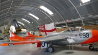
 Malta Aviation Museum is an aircraft museum situated on the site of the former Royal Air Force airfield in the village of Ta’Qali, on the island of Malta. The museum, based in three hangars, covers the history of aviation on the island with exhibits, particularly from the Second World War and post-war periods. The museum is involved in the preservation and restoration of aircraft, some of which are in airworthy condition.
Continue reading Photos of Malta Aviation Museum
Galleries
Photos of Mdina
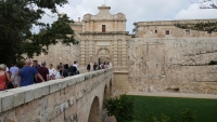 Mdina, also known by its Italian-language titles Città Vecchia (“Old City”) and Città Notabile (“Notable City”), is a fortified city in the Northern Region of Malta which served as the island’s capital from antiquity to the medieval period. The city is still confined within its walls, and has a population of just under 300, but it is contiguous with the town of Rabat, which takes its name from the Arabic word for suburb, and has a population of over 11,000.
Continue reading Photos of Mdina
Photos of Marsaxlokk, Malta
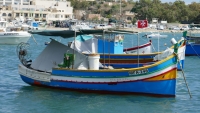 Marsaxlokk is a small, traditional fishing village in the South Eastern Region of Malta. It has a harbour, and is a tourist attraction known for its views, fishermen and history. The village is also known for the Marsaxlokk Market, which is mainly a large fish market which takes place along the seafront on Sundays, and a tourist market during all other days of the week. Inhabited and well-known since antiquity, Marsaxlokk was used as a port by Phoenicians, Carthaginians and also has the remains of a Roman-era harbour.
Continue reading Photos of Marsaxlokk, Malta
Photos of Vientiane, Laos
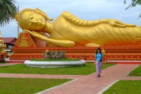 Vientiane is the capital and largest city of Laos, on the banks of the Mekong River near the border with Thailand. Vientiane became the capital in 1563 due to fears of a Burmese invasion but was later looted then razed to the ground in 1827 by the Siamese (Thai). Vientiane was the administrative capital during French rule and, due to economic growth in recent times, is now the economic center of Laos.
Continue reading Photos of Vientiane, Laos
Photos of Barcelona, Spain
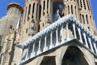 Barcelona is the capital city of the autonomous community of Catalonia in the Kingdom of Spain, as well as the country’s second most populous municipality, with a population of 1.65 million within city limits. Its urban area extends beyond the administrative city limits with a population of around 4.7 million people, being the seventh-most populous urban area in the European Union after Paris, London, Madrid, the Ruhr area, Berlin, and Milan. It is the largest metropolis on the Mediterranean Sea.
Continue reading Photos of Barcelona, Spain
Photos of Spanish province
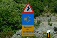 All pictures on this page was created in June-July 2016.
Continue reading Photos of Spanish province
Photos of Ciudad Encantada, Spain
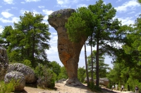 The Ciudad Encantada (Enchanted City) is a geological site near the city of Cuenca, in the autonomous community of Castilla-La Mancha, Spain in which the erosive forces of weather and the waters of the nearby Júcar river have formed rocks into distinctive and memorable shapes. It was declared a Natural Site of National Interest on 11 June 1929. The rock formations of Ciudad Encantada are karst formations, which date back to the Cretaceous period, approximately 90 million years ago.
Continue reading Photos of Ciudad Encantada, Spain
Photos of Cabo de Gata-Nijar Natural Park, Spain
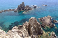 Cabo de Gata-Nijar Natural Park in the south-eastern corner of Spain, is Andalucia’s largest coastal protected area, a wild and isolated landscape with some of Europe’s most original geological features. It is the only region in Europe with a true hot desert climate. The eponymous mountain range of the Sierra del Cabo de Gata with its highest peak El Fraile is Spain’s largest volcanic rock formation with sharp peaks and crags in red/ochre-hues. It falls steeply to the Mediterranean Sea creating jagged 100-metre high cliffs, which are riven by gullies leading to hidden coves with white sandy beaches, some of the most beautiful in Andalucia.
Continue reading Photos of Cabo de Gata-Nijar Natural Park, Spain
Photos of Morella, Spain
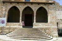 Morella is an ancient walled city located on a hill-top in the province of Castellón, Valencian Community, Spain. The town is the capital and administrative centre of the comarca of Els Ports, in the historic Maestrat (Maestrazgo) region. There are traces of settlement by the Iberians, succeeded by the Greeks and Romans, Visigoths and the Moors. From the early 17th century to the Spanish Civil War, the town was often fought over, due to its strategic situation between the Ebro and the coastal plain of Valencia.
Continue reading Photos of Morella, Spain
Photos of Mojacar, Spain
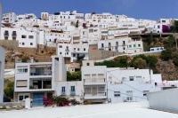 Mojacar is a municipality situated in the south east of the Province of Almeria (Andalucia) in southern Spain, bordering the Mediterranean Sea. It is 90 km from the capital of the province, Almeria. It is an elevated mountain village displaying the traditional white colour from its earlier days.
Continue reading Photos of Mojacar, Spain
