Our trip to Spain, 2016 year
Category: Spain
Spain, officially the Kingdom of Spain, is a sovereign state largely located on the Iberian Peninsula in southwestern Europe, with archipelagos in the Atlantic Ocean and Mediterranean Sea, and several small territories on and near the North African coast. Its Mainland is bordered to the south and east by the Mediterranean Sea except for a small land boundary with Gibraltar; to the north and northeast by France, Andorra, and the Bay of Biscay; and to the west and northwest by Portugal and the Atlantic Ocean. Along with France and Morocco, it is one of only three countries to have both Atlantic and Mediterranean coastlines.
Photos of Barcelona, Spain
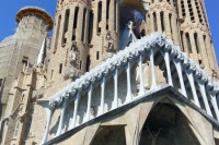 Barcelona is the capital city of the autonomous community of Catalonia in the Kingdom of Spain, as well as the country’s second most populous municipality, with a population of 1.65 million within city limits. Its urban area extends beyond the administrative city limits with a population of around 4.7 million people, being the seventh-most populous urban area in the European Union after Paris, London, Madrid, the Ruhr area, Berlin, and Milan. It is the largest metropolis on the Mediterranean Sea.
Continue reading Photos of Barcelona, Spain
Photos of Spanish province
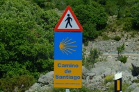 All pictures on this page was created in June-July 2016.
Continue reading Photos of Spanish province
Photos of Ciudad Encantada, Spain
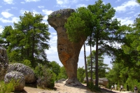 The Ciudad Encantada (Enchanted City) is a geological site near the city of Cuenca, in the autonomous community of Castilla-La Mancha, Spain in which the erosive forces of weather and the waters of the nearby Júcar river have formed rocks into distinctive and memorable shapes. It was declared a Natural Site of National Interest on 11 June 1929. The rock formations of Ciudad Encantada are karst formations, which date back to the Cretaceous period, approximately 90 million years ago.
Continue reading Photos of Ciudad Encantada, Spain
Photos of Cabo de Gata-Nijar Natural Park, Spain
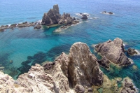 Cabo de Gata-Nijar Natural Park in the south-eastern corner of Spain, is Andalucia’s largest coastal protected area, a wild and isolated landscape with some of Europe’s most original geological features. It is the only region in Europe with a true hot desert climate. The eponymous mountain range of the Sierra del Cabo de Gata with its highest peak El Fraile is Spain’s largest volcanic rock formation with sharp peaks and crags in red/ochre-hues. It falls steeply to the Mediterranean Sea creating jagged 100-metre high cliffs, which are riven by gullies leading to hidden coves with white sandy beaches, some of the most beautiful in Andalucia.
Continue reading Photos of Cabo de Gata-Nijar Natural Park, Spain
Photos of Morella, Spain
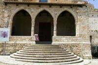 Morella is an ancient walled city located on a hill-top in the province of Castellón, Valencian Community, Spain. The town is the capital and administrative centre of the comarca of Els Ports, in the historic Maestrat (Maestrazgo) region. There are traces of settlement by the Iberians, succeeded by the Greeks and Romans, Visigoths and the Moors. From the early 17th century to the Spanish Civil War, the town was often fought over, due to its strategic situation between the Ebro and the coastal plain of Valencia.
Continue reading Photos of Morella, Spain
Photos of Mojacar, Spain
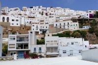 Mojacar is a municipality situated in the south east of the Province of Almeria (Andalucia) in southern Spain, bordering the Mediterranean Sea. It is 90 km from the capital of the province, Almeria. It is an elevated mountain village displaying the traditional white colour from its earlier days.
Continue reading Photos of Mojacar, Spain
Photos of San Juan de Gaztelugatxe, Spain
Gaztelugatxe is an islet on the coast of Biscay belonging to the municipality of Bermeo, Basque Country (Spain). It is connected to the mainland by a man-made bridge. On top of the island stands a hermitage (named Gaztelugatxeko Doniene in Basque; San Juan de Gaztelugatxe in Spanish), dedicated to John the Baptist, that dates from the 10th century, although discoveries indicate that the date might be the 9th century. With another small neighboring island, Aketze, they form a protected biotope that extends from the town of Bakio until Cape Matxitxako, on the Bay of Biscay.
Continue reading Photos of San Juan de Gaztelugatxe, Spain
Photos of Tablas de Daimiel National Park, Spain
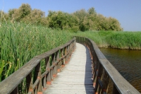 Tablas de Daimiel National Park (Parque Nacional de las Tablas de Daimiel) is a wetland on the La Mancha plain, a mainly arid area in the province of Ciudad Real. With an area of about 3,000 ha, the park is the smallest of Spain’s fifteen national parks. The protected area is in the process of being expanded outside the original nature reserve to include neighbouring dryland farming areas. The expansion is part of efforts to improve the condition of the wetland, which has been damaged by over-exploitation of water resources.
Continue reading Photos of Tablas de Daimiel National Park, Spain
Photos of Chinchilla de Monte-Aragon, Spain
Chinchilla de Monte-Aragon, more commonly just Chinchilla, is a municipality in the province of Albacete in Castile-La Mancha, (Spain) in the region of La Mancha Montearagon. This town is located 15 km from the capital of the province. In 2008, with 3,660 inhabitants, according to INE data, but according to water consumption data are estimated about 5,000 since many are not registered in this town used by many as a dormitory town of Albacete.
Continue reading Photos of Chinchilla de Monte-Aragon, Spain
